In the world of geophysics and remote sensing, mapping autonomously using drones is emerging as the go-to technology for detecting buried metal objects, exploring for the presence of extractable resources and mapping the extent of unseen environmental contamination. Ron Bell, a senior geophysicist with Drone Geoscience, LLC, shared insights on the most effective methods for specific mapping missions, backed by real-world examples that demonstrate the immense potential of uncrewed aerial systems (UAS) configured with a geophysical sensor. These advancements promise to reshape our understanding of what lies beneath the Earth’s surface, establish support for new frontiers in research by the geoscientific community as well as practical applications that could improve our collective understanding of the earth and earth processes.
Introduction to Autonomous Mapping of Geoscience Data
To provide context, Bell provided an overview of the geoscience measurement space. He divided the field into two main categories: Remote Sensing, which covers everything above the surface and Geophysics, which addresses everything below the ground surface.
Autonomous mapping refers to the fusion of drone technology, sensors and software to collect data about both Earth’s surface and subsurface using these techniques. Bell emphasized that while he mainly focuses on airborne robots, the field of autonomous mapping extends to marine and terrestrial robotics as well.
“The objective,” Bell explained, “is to inform decision makers about the surface and subsurface of the Earth. And one of the most promising applications for autonomous mapping is the detecting and delineating buried metal objects.”
Expert Tips for Effectively Mapping Buried Metal Objects with Drones
Autonomous mapping capabilities have significant implications for various sectors, including archaeology, construction and environmental remediation. By leveraging advanced sensing technologies and precise flight control, drones can efficiently survey large areas and detect hidden metallic structures with remarkable accuracy.

Bell believes that integrating data from various sources produces the best results for any mission. Each collection method comes with its own pros and cons. He provided his thoughts on which method works best for which applications.
Thermal Imaging
“Thermal imaging has emerged as a powerful tool in this field,” he said. Drones equipped with high-resolution thermal cameras can detect subtle temperature differences on the ground surface, which may indicate the presence of buried metal objects. These objects often retain heat differently than the surrounding soil. This creates detectable thermal signatures. For remote pilots, Bell suggested employing thermal imaging in the early morning or late evening when temperature contrasts are most pronounced.
Magnetic Surveys
According to Bell, magnetic surveys conducted by drones offer another effective approach. By utilizing highly sensitive magnetometers, these drones can measure minute variations in the Earth’s magnetic field caused by ferrous metals beneath the surface. Bell recommends this technique for those seeking to locate larger buried objects or structures, because they create more significant magnetic anomalies, and are more time efficient for mapping larger areas. Drone magnetic surveys provide an efficient method of locating legacy oil and gas wells and pipelines.
Electromagnetic Methods
Bell focused particularly on the advantages of electromagnetic (EM) induction methods over traditional magnetic surveys. Drones can be outfitted with various electromagnetic sensors, including metal detectors and conductivity meters. These devices, such as the “very focused metal detector” capability in the EM61Lite system, transmit a time varying electromagnetic field and measure the anomalous responses from induced electrical currents flowing in the buried ferrous and non-ferrous metal objects.
To identify objects at greater depths, Bell recommends using very low frequency (VLF) electromagnetic methods or the semi-airborne EM (SAEM) technique, as they are particularly suited to penetrating deeper into the ground.

Speaking of penetrating the ground, as its name suggests, ground-penetrating radar (GPR) represents one of the most advanced methods for subsurface mapping. Drones equipped with GPR systems can send high-frequency radio waves into the ground and analyze the reflected radio wave signals to create a detailed 3D image of the buried object. This technology excels at providing precise depth and shape information and makes it an invaluable tool for complex mapping projects within the shallow subsurface.
Altitude of Flight Operations
For Bell, the best data relating to buried object detection comes not just from the integration of these sensing technologies fitted to the drone platforms, but also the altitude at which the drone traverses over the ground surface. Operators can adapt their survey strategies to optimize data collection for different environments and object types by operating at various altitudes. Bell created his own classification of drone operational altitudes for maximized impact:
- Ultra-low altitude: 0.5 to 5 meters above ground level (AGL)
- Low altitude: 5 meters to treetop level (approximately 30 meters)
- Full altitude: Treetop level to regulatory limit
- Standard altitude: Regulatory limit and above (with waivers)
In his assessment, understanding these classifications can minimize constraints while increasing opportunities in data collection while maintaining safe flight operations.
Interference Mitigation
Bell highlighted several sources of noise that can affect instrument performance in terms of time domain electromagnetic (TDEM) methods for metal detection These include ambient electromagnetic interference, motion-related noise and terrain effects.
“Understanding and mitigating these noise sources is crucial for effective metal detection using TDEM techniques,” Bell emphasized. Operators must consider these factors when designing and implementing autonomous mapping surveys, especially in complex environments.
Case Studies: Real-World Applications of Autonomous Drone Mapping Technology
To illustrate the real-world applications of autonomous mapping technologies, Bell presented several compelling case studies that demonstrated the versatility and efficiency of the methods he described.
Pipeline and Well Detection Using Total Magnetic Intensity
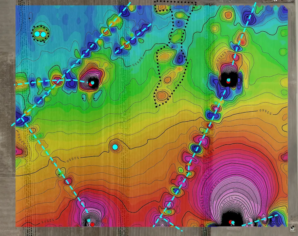
One of Bell’s case studies showcased the use of Total Magnetic Intensity (TMI) surveys for locating oil and gas wells and pipelines. Bell explained how he used the MagArrow, a highly sensitive UAV magnetometer to autonomously the magnetic field of the earth as the means for identifying the location of oil and gas wells and flowlines.
“This is a project I did in eastern Colorado about 2 or 3 years ago. We were flying the MagArrow at an altitude of 20 meters in a lawnmower fashion using an equivalent line spacing scan approximately four (4) square miles looking for pipelines. We were able to identify the pipelines because of the continuous linear string of both positive and negative anomalies.”
He continued, “The MagArrow has revolutionized our ability to locate poorly documented, historical oil and gas infrastructure including orphaned wells efficiently,” Bell stated. “By creating detailed color contour maps of the magnetic data, we can pinpoint buried, often abandoned, structures with unprecedented accuracy. This allows for better environmental and safety management and date informed decisions pertaining to remediation of forgotten or poorly documented oil and gas infrastructure.”
UAV Magnetic Survey for Landfill Characterization
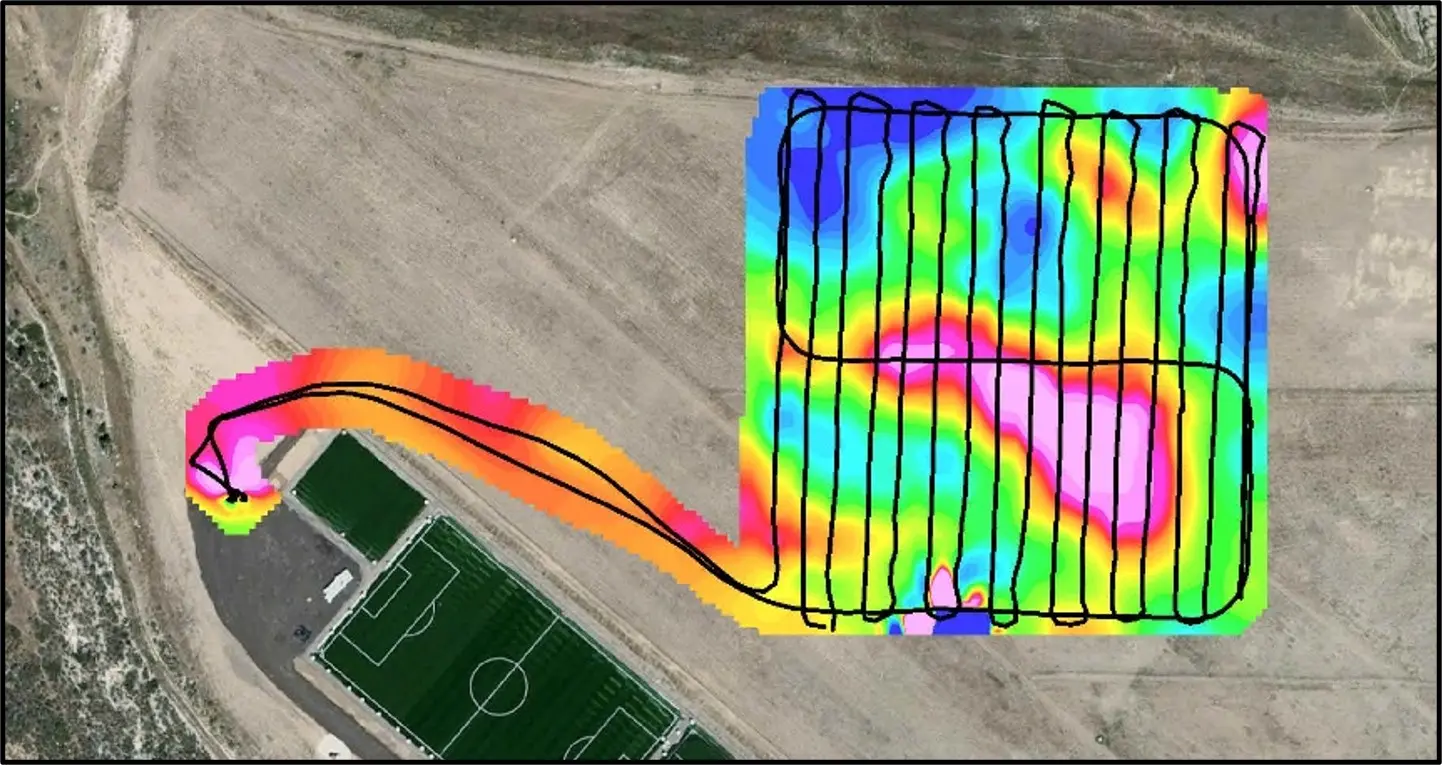
Bell also discussed a project where drone magnetic surveys were employed to characterize a landfill. The primary objective was to identify zones containing steel and iron objects within the landfill area. This technique proved to be highly efficient in mapping and detecting metallic objects through valuable insights into the composition and distribution of buried materials.
Advanced Pipeline Detection with EM61Lite
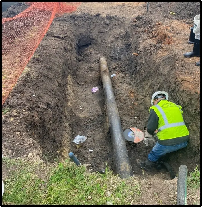
Bell also described a project where he employed the EM61Lite system suspended under a DJI Matrice 600 Pro drone to detect buried pipelines and other metallic objects prior to excavation. This survey illustrated how combining data from different channels and survey directions could enhance the overall picture of buried objects.
The methodology involved collecting data in both east-west and north-south directions at an altitude of approximately 1 meter above ground level (AGL). Bell and his team completed data collection in less than 2 hours, and the data was processed and visualized in the field immediately after the collection.
Bell elaborated on the data processing techniques used in this project: “We applied a 2D Hanning filter to smooth out level shifts between individual survey data sets. Additionally, a 2D vertical derivative filter was employed to enhance conductivity anomalies in the data, allowing us to sharpen our focus on potential pipeline locations.”
The results of merging data sets from north-south and east-west flight lines provided a more complete representation of the subsurface environment. “By synthesizing data from multiple perspectives, we can overcome limitations inherent in single-direction surveys and reveal a more nuanced understanding of the buried infrastructure,” Bell noted. He footstomped how integrating these various data sources and techniques achieves the most comprehensive understanding of subsurface conditions.
And the outcome was remarkable. The post-acquisition processing also revealed an unexpected level of detail about the buried metal in the area. One of the most significant findings was the identification of a previously unknown water pipeline on the west side of the area of interest.
Limitless Applications of Autonomous Mapping Technology
As the field of autonomous mapping continues to rapidly evolve, Bell envisions even further expanded applications in environmental site characterization, soil mapping and analysis for improved agricultural yields and the exploration for groundwater, battery minerals and energy resources.
“As the only living geoDRONEologist on planet Earth, I can confidently say that we’re at the cusp of a revolution in how we understand and interact with the subsurface environment,” Bell effused. “The fusion of drone technology with advanced geophysical methods is opening up new frontiers in exploration, environmental monitoring and infrastructure management.”
As the drone industry continues to innovate, we can expect even more sophisticated methods for mapping buried metal objects to emerge. These advancements will not only improve the efficiency and accuracy of detection but will encourage new thinking about the possibilities for exploring and understanding what lies beneath the surface.
“We’re only scratching the surface of what’s possible – no pun intended,” Bell said. “As we refine our techniques and integrate new technologies, the potential applications are boundless.”
“The fusion of drone technology with advanced geophysical methods is opening up new frontiers in exploration, environmental monitoring and infrastructure management.”
- Ron Bell, senior geophysicist at Drone Geoscience, LLC and geoDRONEologist

