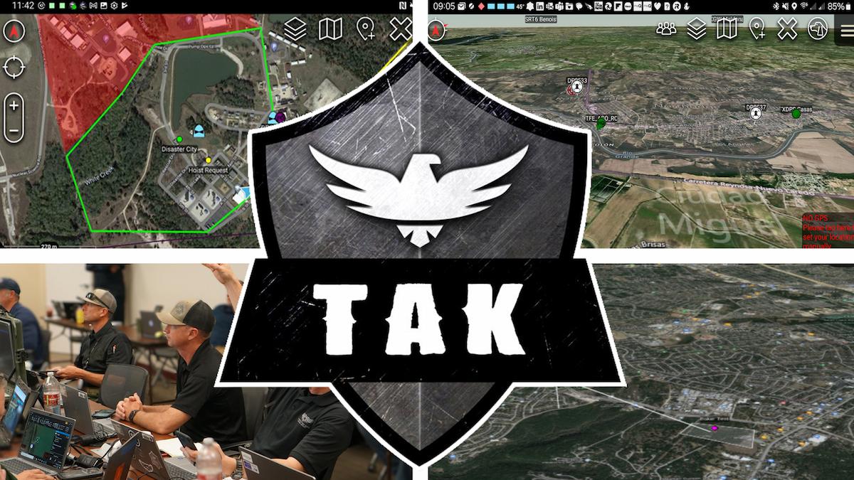
What the TAK?
Team Awareness Kit (TAK) as a suite of georeferenced imagery and communications tools that allow for scaled operational planning, data sharing, visualized elevation data, and target management. With TAK, your team can get oriented quickly, make better informed decisions and quickly respond to threats. Simply put, TAK is a mobile friendly, dots on a map technology that allows agencies to visualize multiple data sets. Some of the common data that can be visualized is:
- Personnel
- Vehicles
- Unmanned Aircraft
- Public safety manned aircraft
- ADS-B equipped aircraft
- Drone detection/Remote ID
- Security cameras
- User placed markers/targets

Team Awareness Kit (TAK) has taken public safety by storm. This system was initially created in 2010 by the Air Force Research Laboratory for use by the military, known as Tactical Awareness Kit. In 2017, DHS personnel and SLTTs began using the system to coordinate disaster response fur Hurricanes Harvey, Irma and Maria.
The Department of Homeland Security (DHS) Science and Technology Directorate (S&T) deploys the Team Awareness Kit (TAK) to support the complex communication and coordination needs of a multi-jurisdictional incident response. TAK is a cost-effective, government off-the-shelf solution developed by the Department of Defense to enable tactical data to be generated, visualized, and shared, facilitating communication across multiple users to achieve shared tactical awareness.
TAK can be utilized on 3 different platforms, each having different capabilities. ATAK, Android Team Awareness Kit, has the most features, funding and development and is used on Android mobile devices. WINTAK, Windows Team Awareness Kit, contains most of the features in ATAK and can be installed on a Microsoft Windows based computer. iTAK, iOS Team Awareness Kit, does not have the same feature parity as ATAK but still allows for situational awareness and team coordination.

TAK for Public Safety?
Public Safety has always suffered from a lack of no cost/low cost tools that allow for multi-agency/multi-team coordination. The use of mobile devices for situational awareness is constantly increasing but agencies are required to have multiple apps to accomplish simple tasks. TAK has been found to solve this problem by providing a single pane of glass for most agency needs. TAK is very different from most other apps or services, these differences are best articulated by Jared Vandenheuvel, Director of the Public Safety Solutions Center for Texas DPS.
“TAK has some crucial differentiators that make it highly relevant to the public safety community. The open-source nature of it means that an agency with the technical skill can host users, including from partner agencies, without worrying about recurring license costs.
The open and extensible ecosystem of TAK is important. Public safety has a lot of niche hardware and niche use cases. TAK provides a common ecosystem for some of these niche solution providers to build on, with the added benefit that there is a large incumbent user base of TAK, particularly the military and some federal agencies.”
Texas TAK is a successful model!
In 2021, Texas DPS, under the leadership of Jared Vandenheuvel, began exploring TAK through use of the FBI hosted server. The bureau offers public safety the ability to stand up an instance of TAK on the FBI server at no cost. Working with Mike Teigen (FBI), DPS was quickly able to start the crawl-walk-run into TAK. Michelle Duquette with 3MadAir describes this process.
“While I subscribe to “Crawl-Walk-Run” in general, when we focus on applying that approach to only the technology, we often miss the ability to “learn by doing.” Then implementation is a slow struggle, working out the kinks of adding the tech to existing human roles in the real world. TAK is showing how we can and should do both simultaneously.”
Although the use of the FBI server highly beneficial for many agencies, DPS realized that in order to be able to utilize TAK at scale, an in-house server would need to be stood up. Jared and his team took on this monumental task and DPS quickly had a server online. Through the efforts on the backend by the department’s TAK developer, Paul Brown and TAK Program Manager, Brandon Albert, the DPS TAK program grew legs quickly and other agencies reached out asking to leverage the power of TAK.
Within 18 months, what went from dots on a map inside DPS evolved into Texas TAK. The DPS TAK server now hosts approximately 50 agencies across the state and is federated with the Texas Military Department, FBI and CBP.
“The Texas TAK program has been successful in part because there is no competition; most multi-agency events and responses have no common map, no common tools beyond radio. TAK is the right price (free) that agencies are willing to pay.” Jared Vandenheuvel, Texas DPS
Through partnerships with vendors, other capabilities were incorporated at a rapid pace. Texas DPS, having such an effective UAS program, this seemed to be a natural place to start with the 3rd party integrations. Working with DroneSense, DPS and agencies across the state were able to see UAS position and live video in TAK.

“TAK is the “Walk” phase of human-drone teaming in Public Safety. TAK serves as the confluence of individual teams and mission command using new tech together. With a focus on shared intelligence that gives command and each team the exact type and level of position situational awareness they need, DPS has enriched individual team efficiencies and the safety of an entire Public Safety mission.
Texas DPS first mastered introducing drone capabilities into its individual missions (e.g., LE example, fire example, security example, mapping example, etc.), each applying the new capabilities in more complex situations as they learned.” Michelle Duquette, 3MadAir
TAK for Airspace Safety?
Since its inception, Texas DPS has continued to find ways to leverage the power of TAK. In addition to being able to visualize all the department’s drones, DPS was able to include additional airspace awareness mechanisms to achieve a complete picture of the NAS. Drone detection and ADS-B data was integrated, then through a partnership with Shotover, DPS was able to incorporate TAK directly into the moving map in many of the department’s AStar helicopters.
“Any discussion of TAK should acknowledge its roots as an air-to-ground coordination tool for the warfighter overseas. Many of the features developed for that use case are directly transferrable to public safety aviation and UAS operations. TAK has a 3D globe; it can incorporate geospatial metadata in video to project live imagery directly onto the globe. It features a host of coordination tools to speed up the process of navigating to the right location, or putting eyes on the target, whether it be a suspect, a vehicle, a fire, or a person in distress.” Jared Vandenheuvel, Texas DPS
DPS can now utilize TAK to see friendly drones, unknown drones, civilian aircraft and public safety aircraft, all in one, simple, common operating picture. This allows emergency management teams at all size events to not only have full airspace awareness but be able to deconflict that airspace. Many believe that this model is a microcosm for UTM and the lessons learned should be examined at by the FAA, NASA and UTM providers.
Can UTM learn from TAK?
Complete and effective airspace awareness and deconfliction methods are the goal of many. As AAM technologies continue to operate in the same space as public safety, mechanisms are needed to prevent airspace incursions.
“Deconfliction is another one of those words tossed around in the Buzz Word Salad that holds several different definitions. As I’ve said in my own article, a luncheon of Buzz Word Salad leaves people starving at your table. No bueno.

When Public Safety references how they use TAK deconfliction capabilities, the term includes managing geographically overlapping team operations and their collective communications but does not include air asset identification and tracking outside of the TAK node network. This is where aviation deconfliction is needed. “ Michelle Duquette, 3MadAir
NASA has been proactively engaging public safety when working on UTM mechanisms. Al Capps with NASA, has actively engaged agencies in the DFW area to work through use cases and identify any areas of concern. The North Texas Key Site is an ideal environment to pressure test UTM and learn from the collaboration that already exists with TAK
“Commercial UAS Service Suppliers (USSs) are providing aviation-defined deconfliction for sUAS operating at low altitudes. Their shared interoperability forms a system we call UAS Traffic Management, or UTM. A bi-directional conduit of information is needed between the USS network and TAK network.
Learning from early field trials with proactive commercial service suppliers shows a clear collective advantage to sharing data with the data source-agnostic TAK for all decision-makers within the event area. Aviation deconfliction is executed with UTM, Public Safety deconfliction is executed with TAK, and together a holistic Public Safety event is effectively managed that considers the safety of commercial flights with shared situational awareness that is deliberate and relevant to every stakeholder.” Michelle Duquette, 3MadAir
The future of TAK!
It should be acknowledged that, although Texas has a successful TAK program, it is just one of many. The proliferation of TAK among all disciplines in public safety cannot be overstated. Colorado is leading the charge in the use of TAK for statewide wildfire management. Agencies from California to New York are either currently utilizing TAK or are in the process of standing up their program.
Start ups are showing up all over the country solely focused on TAK development or integration. It is not unreasonable to consider TAK a disruptive technology in the public safety realm. And, although TAK is a mature product, the development on the civilian side is still in its infancy. The state of TAK is the true definition of a force multiplier, but the future of TAK will redefine what collaboration looks like.