Black Swift Technologies (BST) has developed unmanned aerial systems (UAS) for cutting-edge research applications in the geosciences. Founded in 2011 by Dr. Jack Elston and Dr. Maciej Stachura, BST has changed the way scientists study severe weather phenomena, environmental conditions and natural disasters.
The Genesis of Black Swift Technologies
Elston’s journey into UAS development began during his doctoral research at the University of Colorado Boulder, where his team became the first to intercept a tornadic supercell thunderstorm using a UAS. They conducted over 72 missions in extreme conditions without losing a single aircraft.
This first-of-its-kind work revealed the limitations of existing autopilot systems for geoscience applications. As a result, Elston and his team began developing their own solutions tailored specifically for environmental research.
BST’s Unique Approach to UAS Development
BST’s comprehensive in-house development process sets it apart. The company designs its own autopilot systems, printed circuit boards (PCBs), communication protocols, intuitive user interfaces, and payloads. This end-to-end approach enables BST to rapidly adapt to new challenges and create solutions for customer applications without relying on third-party modifications. A small but mighty company (of just ten people), BST has managed to create a diverse range of UAS platforms and software tailored to a wide variety of environmental conditions.
The BST UAS Fleet

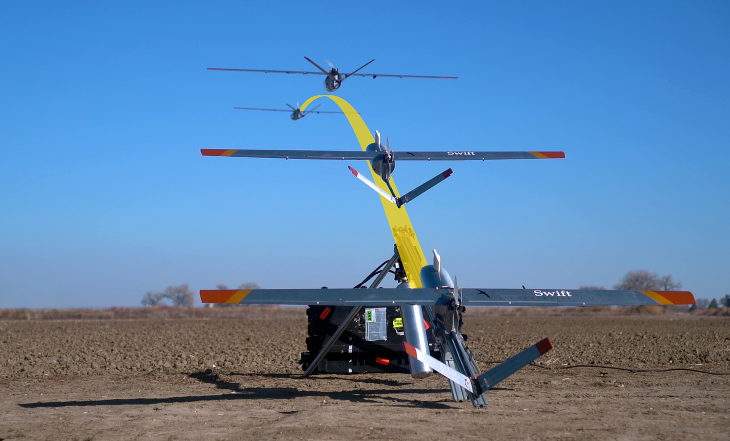
BST’s primary focus has been on fixed-wing UAS. Its flagship model, the S2, boasts a 10-foot wingspan and composite construction. This aircraft features pneumatic launch and landing capabilities and a payload capacity of about 5 pounds with hot-swappable payloads in a 2-foot long, 8-inch diameter section.
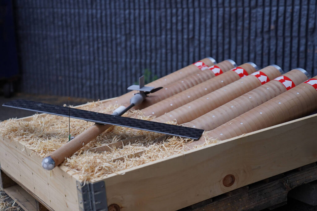
In addition to the S2, BST has developed smaller aircraft like the S0, which comes in two variants: vertical takeoff and landing (VTOL) and tube-launched for deployment from crewed aircraft. Operators use these smaller UAS primarily for environmental sensing and taking atmospheric science measurements such as pressure, temperature, humidity and wind speed.
Software: The Brain Behind the Drones
BST’s success isn’t just about hardware. The company’s proprietary software plays a crucial role in the effectiveness of their UAS platforms.
BST develops its own autopilot systems, allowing for precise control and navigation in extreme conditions. This custom software enables their drones to maintain stability in high winds, navigate complex flight paths and adapt to changing environmental conditions in real-time.
BST’s software doesn’t just control the drones; it also processes and analyzes the vast amounts of data collected during flights. This integrated approach allows for real-time data visualization, rapid identification of critical information and seamless integration with existing weather models and prediction systems.
Pioneering Applications in Extreme Weather
As climate change continues to influence weather patterns and increase the frequency and severity of natural disasters, the work of companies like BST has become increasingly vital. BST’s commitment to pushing the boundaries of UAS capabilities has led to significant advancements in operating UAS under extreme conditions. The company’s aircraft have been designed to withstand high-altitude flights, strong winds and turbulence, freezing temperatures, and corrosive volcanic gases. These robust designs enable BST to collect data in environments that were previously inaccessible or too dangerous for crewed aircraft.
Storm Chasing and Tornado Research
BST’s roots in severe weather research have led to radical applications in storm chasing and tornado studies. The founders helped to develop the “Tempest” UAS as part of the NSF-sponsored VORTEX2 project, to explore the rear flank downdraft of supercell thunderstorms (the breeding ground for tornadoes), an area previously difficult to measure due to the lack of water to scatter radar returns.
This research has significant implications for improving tornado prediction and warning systems. By gathering data from within the storm using UAS (think: Twisters movie-style), researchers aim to better understand the conditions that lead to tornado formation, improve forecasting accuracy and reduce false alarms.
Soil Moisture Monitoring
One of BST’s most versatile applications has been in soil moisture monitoring. The company developed an L-band-based system capable of measuring soil moisture content up to 8-10 inches below the surface. This technology has found applications across various fields including agriculture, golf course management, watershed studies and wildfire management.
For agriculture, mapping moisture levels in irrigated plots helps to optimize water usage and crop health. Golf course owners benefit from BST’s high-resolution soil moisture data to improve turf maintenance and irrigation strategies for land management. BST has also collaborated with NOAA to map snowpack and soil moisture changes in mountainous regions and with the USGS to assess fuel moisture levels and predict fire behavior. By providing high-resolution soil moisture data, BST’s technology helps optimize water usage, improve crop health and assess wildfire risks.
Volcanic Gas Monitoring
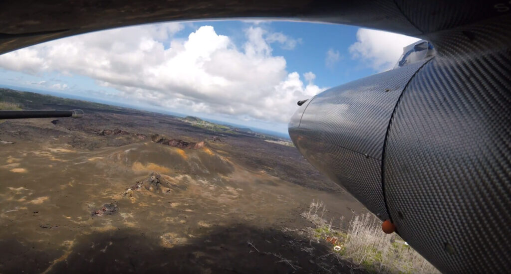
By developing UAS capable of measuring CO2 levels near active volcanoes, BST has expanded its expertise to include volcanic gas monitoring. In Costa Rica, the company conducted flights at altitudes of up to 11,000 feet to locate gas vents on the sides of volcanoes. The UAS’ ability to operate in challenging conditions – that included 50-knot winds and freezing temperatures – enabled scientists to regularly monitor volcanoes that they could previously only visit once every two years. This data will help scientists to understand the environmental impact of increased atmospheric CO2 levels on plant life and ecosystems.
Elston explained the significance of this work. ”We mapped that entire volcano with these flights and got as low as possible flying around it,” he said. “We did tens of flights on the volcano to cover the whole thing. At the end, we were able to give them a map and say, ‘These are the spots where all this gas is coming out – this type of gas here, that type of gas there.’ And they’re able to go do their experiments to figure out what was going to happen to the vegetation,” he continued.
Hurricane Research

BST’s work in hurricane research has significantly advanced atmospheric science. The company developed a tube-launched UAS that can be deployed from NOAA P-3 hurricane Hunter aircraft. This allows for data collection within the lower levels of hurricanes where critical interactions between the storm and ocean occur, areas too treacherous for crewed aircraft.
Elston described the importance of his tech in this application. “They really want to know the bottom layer of the storm,” he explained. “It’s really hard for the radar of the P-3 to get all the way down to the sea surface, and those dropsondes they drop through usually get only about a couple of data points down in the region they really care about.”
The BST UAS can fly as low as 30 feet above the ocean surface while collecting data at five times per second during flights up to 90 minutes. These resilient drones can withstand winds up to 173 mph while autonomously finding and staying in maximum wind areas or locating the storm’s center without operator input, with for extended flight times of up to 105 minutes. This operational resilience has led to unprecedented data collection. As a result, meteorologists now have the potential to significantly improve hurricane forecasting accuracy.
In September 2024, BST’s technology played a crucial role in studying Hurricane Helene, a Category 4 storm that pounded the Eastern Seaboard. The company’s tube-launched drones, deployed from NOAA’s P-3 aircraft, penetrated the eyewall of Helene at altitudes as low as 100 feet above the ocean surface.
During one particular flight, as a BST drone recorded wind speeds exceeding 150 mph, it nevertheless maintained stable flight. Other missions lasted up to 105 minutes with nearly 9 hours of observation of vital data on wind speeds, pressure gradients and sea surface temperatures. This allowed NWS forecasters to make more accurate predictions about Helene’s path and intensity. This life-saving data improved evacuation planning and resource allocation. It will now continue to enhance scientists’ understanding of hurricane dynamics and improve forecast models for future storms.
According to Elston,”Legitimately, this could change our understanding of hurricanes and the fact that we can get a lot better warnings about when and where it’s going to hit and what strength it’s going to be, will hopefully save lives and property.”
Fire Weather Prediction
In addition to hurricane research, BST has applied its UAS expertise to fire weather prediction. In collaboration with NASA, BST is working on providing real-time data to fire incident command centers. Its UAS can operate in the strong winds often present during wildfires, which offers a unique perspective on fire behavior and spread.
BST’s drones also provide high-resolution mapping capabilities so firefighters and researchers can identify hotspots, track fire progression and assess post-fire damage. This detailed information is crucial for both immediate response and long-term recovery efforts.
BST’s collaboration with National Center for Atmospheric Research (NCAR) on the Marshall Fire demonstrated that even limited UAS data collection can significantly improve fire weather forecasts. The use of UAS to gather atmospheric data in the fire-affected areas allowed for improved predictions of wind patterns and fire behavior. This collaboration proved that even limited UAS data collection can enhance fire weather forecasts up to eight hours in advance and provide crucial information for firefighting efforts and public safety.
The Future of Disaster Research
BST’s innovative drones and software stand at the forefront of disaster research by providing crucial data into some of nature’s most powerful phenomena. Ultimately, the company aims to enhance public safety through improved understanding of natural disasters and contribute to more accurate warnings, better-informed disaster response strategies and improved long-term planning. Elston aptly summarized, ”We’re a platform to get data from where we couldn’t get data from before.” From hurricanes like Helene to tornadoes and wildfires, BST’s technology will undoubtedly continue paving the way for a safer future in the midst of increasing environmental challenges.
BST has its comprehensive in-house development process and designs its own:
- Autopilot systems
- Printed circuit boards (PCBs)
- Communication protocols
- User interfaces
- Payloads
- Ground station
- User interface software
- Aircraft Design
BST has purposefully designed its aircraft withstand extreme environments:
- High-altitude flights (up to 10,000 feet and beyond)
- Strong winds and turbulence
- Freezing temperatures
- Corrosive volcanic gasses

