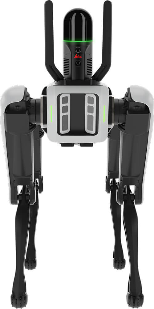
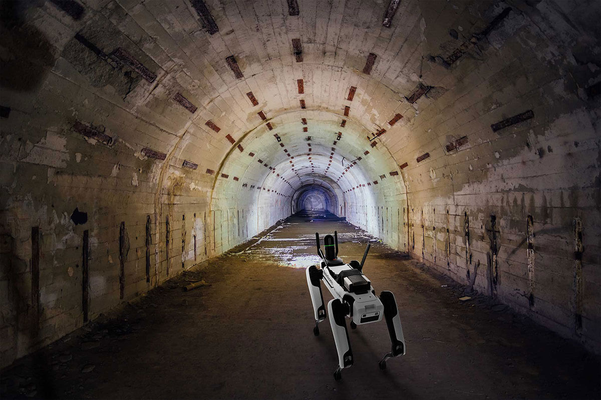
When data is paramount, the ability to collect accurate information in hazardous or inaccessible environments becomes increasingly crucial. The dynamic duo of Leica Geosystems’ BLK ARC sensor and Boston Dynamics’ Spot robot dog has redefined how enterprise users approach tasks that have traditionally been difficult, dangerous or even impossible for humans to perform. This robot-meets-sensor combination pushes the boundaries of what’s possible for mapping, surveying and data collection, especially in GPS-denied environments.
Automating Data Collection
The integration of Leica’s BLK ARC sensor with Boston Dynamics’ Spot robot dog provides significant advantages for autonomous data collection. This robotic system can navigate and map areas where GPS signals are weak or non-existent, such as underground mines, dense urban environments or disaster-stricken areas. The BLK ARC, a sophisticated 3D reality capture sensor, works in harmony with Spot’s agile quadruped design, to create a mobile scanning platform that can go where humans fear to tread.
Navigating the Unnavigable
One of the most notable features of this robotic system is its ability to operate in GPS-denied environments. Traditional surveying and mapping techniques often rely heavily on GPS for positioning and navigation. However, in environments like underground tunnels, dense forests or indoor spaces, GPS signals are often unreliable or completely absent. The BLK ARC and Spot combination overcomes this limitation by using advanced simultaneous localization and mapping (SLAM) technology.
Overcoming GPS Limitations with SLAM Technology
SLAM allows the robot to build a map of its environment while simultaneously keeping track of its location within that map. This is achieved through a combination of sensors – BLK ARC’s LiDAR scanner, onboard cameras and inertial measurement unit. As the robot moves through the environment, it continuously updates its map and position, enabling it to navigate complex and unfamiliar terrains with remarkable accuracy.
Advanced Hardware and Software Integration
The success of this robotic data collection system lies in the seamless integration of hardware and software. While the hardware capabilities of the BLK ARC and Spot are impressive, the real magic happens in the software. The BLK ARC sensor is not merely a passive device carried by Spot; it actively contributes to the robot’s navigation and decision-making processes. This integration allows for real-time data processing and autonomous mission execution. Advancements in AI and machine learning will continue to enable even more efficient data processing and analysis, pushing decision-making capabilities to the field.
Sensor Fusion and Real-Time Processing
The BLK ARC combines multiple sensing technologies, including LiDAR, cameras, and inertial measurement units. This sensor fusion allows for highly accurate 3D mapping and localization. As the robot moves, the BLK ARC continuously scans the environment to capture millions of data points per second. This raw data is processed in real-time which allows the robot to make instant decisions about navigation and obstacle avoidance.
Autonomous Mission Planning
One of the most impressive aspects of this system is its ability to carry out autonomous missions. Users can pre-program scanning routes or exploration patterns, and the robot will execute these missions with minimal human intervention. If the robot encounters an obstacle it can autonomously adjust its path to be able to complete its predefined route. Users can also plan Spot and BLK ARC to do static scans automatically along its path for more comprehensive data collection.
Data Processing and Visualization
In addition to all of these on-board processing capabilities, Leica’s software suite allows for the seamless integration of data from multiple scans to create highly detailed and accurate 3D models of the scanned environment. These models can be used for everything from virtual walkthroughs to precise measurements and analysis.

Versatile Applications Across Industries
The versatility of the BLK ARC and Spot combination opens up a wide range of applications in industries where data collection has traditionally been challenging or dangerous for human workers. From mining and construction to industrial inspections, this robotic system has proven invaluable across various sectors.
Underground Mining and Tunnel Inspection
In the mining industry, where safety is paramount, the ability to inspect and map underground tunnels without putting human lives at risk is invaluable. The robotic system can navigate narrow passages, uneven terrain and low-light conditions to collect detailed 3D scans of mine shafts and tunnels. This data can be used to assess structural integrity, plan expansions, or monitor changes over time, all while keeping human workers out of harm’s way.
Disaster Response and Search and Rescue
In the aftermath of natural disasters or in search and rescue operations, time is of the essence, and the terrain is often treacherous. The BLK ARC and Spot can be deployed to quickly map damaged areas, locate survivors or assess structural damage in buildings that may be too dangerous for human entry. The robot’s ability to navigate rubble, climb stairs and even open doors makes it a critical asset in these high-stakes scenarios.
Industrial Inspection and Asset Management
Large industrial facilities, such as oil refineries or chemical plants, require regular inspections to ensure safety and compliance. Many areas within these facilities can be hazardous or difficult for humans to access. The robotic system can perform routine inspections. It collects detailed scans of equipment and infrastructure without exposing workers to potential dangers. This not only improves safety but also allows for more frequent and thorough inspections. This helps asset owners to spot (no pun) issues before they become critical.
Construction and Infrastructure Monitoring
In the construction industry, the BLK ARC and Spot combination offers a new level of precision and efficiency in project monitoring. The robot can autonomously navigate construction sites and capture detailed 3D scans that can be compared against design models to ensure accuracy and track progress. This is particularly valuable in large-scale projects where manual inspections would be time-consuming and potentially dangerous.
Looking Ahead: The Future of Geospatial Technology
The BLK ARC and Spot combination is just the beginning of a new approach to robotic data collection. The potential for future developments remains vast and exciting, with possibilities ranging from enhanced AI integration to swarm robotics and collaborative mapping.
Imagine a robot that not only collects data but can also analyze it in real-time to identify potential issues or anomalies and adapt its mission accordingly (think: predictive maintenance). Think of a coordinated team of robots that covers vast areas or complex environments in a fraction of the time it would take a single unit. Future versions of this robotic data collection system might be able to identify areas of interest autonomously, decide when and where to take more detailed scans, and even perform basic analysis of the collected data on the fly.
From improving safety in hazardous industries to urban planning, the potential applications are vast and varied. Going forward, be sure to keep a watchful eye out for robotic systems like the BLK ARC and Spot combination. For surely they will play an increasingly important role in how we understand and interact with our world.
*Minor corrections were made on 1/6/25 to the SLAM and navigation sections.

