Enabling Tech

Ctrl: Delivering Actionable Intelligence for Renewable Energy And Disaster Response
Toronto-based Ctrl leads the way in providing actionable intelligence through sophisticated drone technology and innovative data collection methods for the renewable energy sector. Recently, the company has expanded its capabilities...Read More

5 New Things: Geospatial Technologies Unveiled at Geo Week 2025
At the highly anticipated annual Geo Week 2025 conference in Denver, Colorado, known for bringing together professionals from various sectors including surveying, mapping and remote sensing, a number of industry...Read More

Enabling Critical Public Safety Drone Missions With Safety Systems And Training
As drones become increasingly integral to public safety operations, the need for robust safety measures has never been more critical. In a recent episode of the Dawn of Autonomy podcast,...Read More
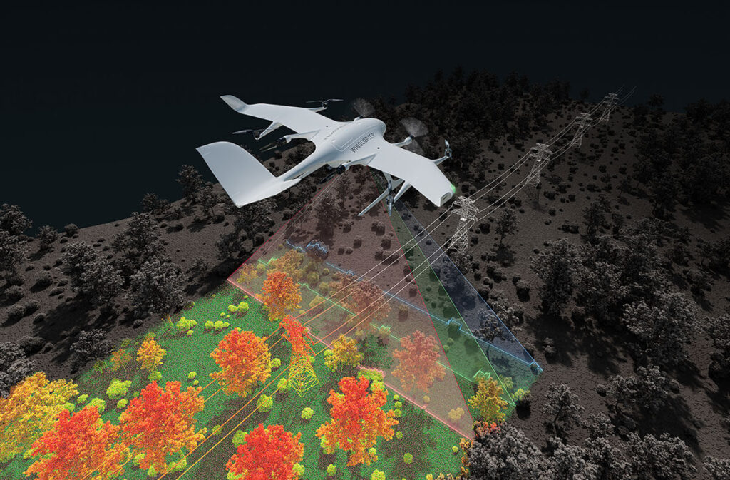
Wingcopter extends range of applications to long-range LiDAR surveying
Weiterstadt, Germany, 10 February 2025 – Wingcopter, a leading German drone manufacturer, seller and service provider, has announced that it will expand its offering beyond cargo drones to include the sale...Read More

Geospatial Technologies: Shaping the Future of Autonomy, National Security And Disaster Response (And More!)
The geospatial industry continues to evolve, with applications in markets that extend well beyond traditional mapping and navigation. At the recent GeoBuiz 2025 conference, industry leaders gathered to discuss the...Read More

Dronetag Introduces RIDER: A Game-Changer for Drone Safety in Response to Growing Airspace Concerns
With recent incidents such as unidentified drone sightings in New Jersey and across the US, and a drone collision with an aircraft battling Los Angeles wildfires, the need for improved...Read More

Skyway and MatrixSpace Partner to Elevate Aerospace Navigation with Advanced Air Traffic and Drone Detection Solutions
Skyway, a leading California-based vertiport development and operations company, and MatrixSpace, a pioneering AI-enabled sensing platform, have announced a strategic partnership to advance the integration of intelligent air traffic management and unmanned...Read More

ANELLO Photonics Launches Maritime Inertial Navigation System at CES 2025, Transforming Maritime Navigation with State-of-the-Art Optical Gyroscope Technology
ANELLO Photonics, the creator of the Silicon Photonic Optical Gyroscope (SiPhOG™) and a leader in high-precision inertial navigation systems, today announced the launch of the ANELLO Maritime INS, its cutting-edge...Read More
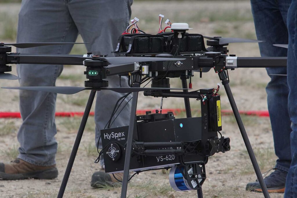
Transforming Mineral Exploration: Breakthroughs in Drone-Based Hyperspectral Imaging
In a groundbreaking development for the mining industry, researchers at North Dakota State College of Science (NDSCS) and the Center to Advance the Science of Exploration to Reclamation in Mining...Read More
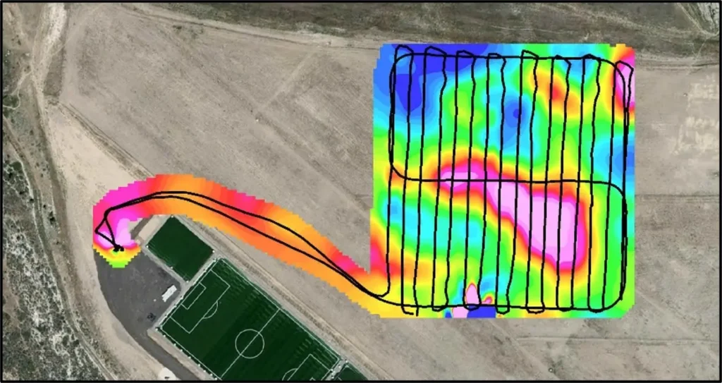
Unlocking Subsurface Insights: Autonomous Drone Mapping Techniques for Buried Metal Detection and Geology
In the world of geophysics and remote sensing, mapping autonomously using drones is emerging as the go-to technology for detecting buried metal objects, exploring for the presence of extractable resources...Read More