In just a few weeks, professionals from the geospatial and AEC (architecture, engineering, construction) industries will be coming together at the Colorado Convention Center in Denver for the annual Geo Week conference, taking place February 10-12. The conference and exhibition are defined by the idea of these industries coming together increasingly under one umbrella, giving professionals and industry leaders a chance to collaborate and share ideas and best practices for three days every year.
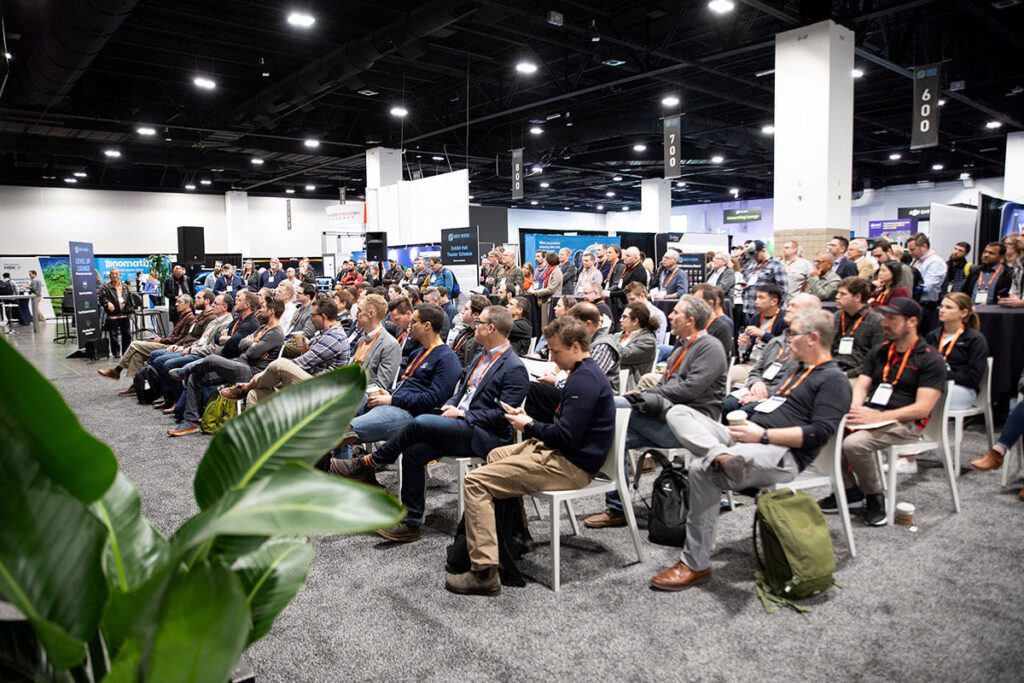
The conference program runs all three days, featuring in-depth presentations from thought leaders and engaging panel discussions between professionals dealing with the same challenges as the ones attendees are facing on a daily basis. Additionally, attendees have access to the exhibit floor, featuring representatives from over 150 of the leading companies in the sector who will be showing off their latest innovations for professionals on the ground, as well as a theater on the floor with even more conference programming.
From learning more about the trends shaping the industry to the networking opportunities on the exhibit floor and everything in between, there is so much to be excited about looking ahead to this show next month. Registration is still open for this event, and you can learn more about what attendees stand to gain below.
Bringing Disparate Data Together
For years, the biggest conversation drivers in the geospatial industry have been the development and improvements of new sensors. From improvements to SLAM algorithms driving greater value from mobile mapping to shrinking sensors enabling more feasible UAV-based lidar scanning, and so much more, the different ways to collect crucial spatial data have seen numerous crucial advancements in recent years. However, just having those tools available is only half of the puzzle. The real value comes from being able to use them all in concert to cover a space in the most optimal way, a barrier that the industry has tried to overcome.
This year, the Geo Week conference program will feature plenty of examples of how we are starting to get over these barriers. Thanks to improved software and technology like artificial intelligence taking massive leaps, it is now simpler than ever to take these different datasets – including not just different lidar sensors but also Earth Observation, IoT, and GIS data, among others – and combine them into a manageable deliverable. Both keynotes, for example, are set to touch on the importance of these workflows and the real value they can bring to high-stress situations and large-scale operations.

Breaking Down Siloes
Speak to anyone working on large projects within the AEC and geospatial industries, and one of the first complaints you are likely to hear is around siloes within the project between stakeholders. Different teams and disciplines stick within their siloes, with data not staying within teams and coming in many different formats that would be difficult to share even if there was a desire to do so. This cross-discipline collaboration between stakeholders is one of the biggest themes of Geo Week every year, and the 2025 event will once again highlight this importance. The conference program, including the aforementioned keynotes, will feature plenty of presentations and discussions providing tangible evidence of the value this kind of collaboration can bring to teams.
It’s not just the program where this importance will become apparent, either. Walking around the show floor, Geo Week gives attendees the unique ability to directly network and connect with professionals in those other disciplines. It’s one thing to hear people talk about their own experiences in this area, but being able to actually have those conversations on the floor during show hours and other networking events adds another dimension. Being able to get the perspective of other disciplines that are often missing in the day-to-day life of professionals in these industries is an invaluable experience that can only be had at this kind of in-person event.
Bringing Projects to a Larger Scale
Looking through this year’s conference program for Geo Week, one of the themes that really stands out is the sheer scale of projects being worked on by today’s professionals. Traditionally, the kind of data collection and digital twin creations we heard about were for individual buildings, facilities, or campuses. While there is still plenty of that happening as well – and plenty of innovation around those workflows as well – these projects are now expanding into significantly larger scales. Attendees of the program will hear about large-scale aerial mapping projects as well as digital twins moving beyond those single buildings and campuses and into cities, states, and even entire nations.
This type of project is still in its relative infancy within the geospatial industry, but Geo Week will feature speakers who are already working on them, giving those who might be interested a chance to hear about challenges they overcame and to ask specific questions they may have. They’ll learn about some of the recent innovations that have helped unlock the possibilities of these large-scale projects and the early benefits they’re already seeing by deploying these digital twins.

Reaching “Phase Two” of Digital Adoption
For years, we’ve heard about the slow process of digital adoption within the AEC industry, which has traditionally lagged behind other sectors. As that adoption has finally started to increase over the last decade or so, Geo Week and other conferences have largely talked about all of the different tools available and what they can do to help justify and speed up digitalization. Now, though, the industry appears to be moving on to something of a “phase two” of this process. The knowledge of the tools is largely there, but now it’s about practically looking at the options and making the right choice for specific problems.
That attitude of practicality figures to be all over the Geo Week conference program this year, with multiple sessions moving beyond the theoretical benefits of certain tools and looking at specific use cases for these technologies. Professionals with AEC firms that have been at the forefront of this technological adoption will speak to what they are looking for when sourcing new technologies and the key questions they want answered in that search. Representatives from technology providers on the exhibit floor will also be available to speak to the specific and practical benefits of their tools.
All of the Newest Technology
Most of this article has focused more on the concepts that will be at the forefront of this year’s Geo Week as opposed to the tangible technology, but there will certainly still be plenty of the latter on display throughout the event. The show kicks off with the annual product previews, giving exhibiting companies a chance to highlight their latest releases, and the floor will be open after that to learn more. Between new hardware like mobile scanners, UAVs, and GNSS receivers as well as the latest software solutions with live demos available, Geo Week remains a must-attend for anyone looking to keep up with the latest and greatest technology available for today’s professionals.
Registration for Geo Week 2025, being held February 10-12 in Denver, Colorado, is still open. Don’t miss your chance to be part of this year’s event!
By: Matt Collins, GeoWeek News

